Fulford battlefied under threat

Find us

1851 map of Fulford

Search


Home
Up
3D view of battle
LIDAR image
Changes
Old maps
1851 map of Fulford
England 1066
Moraines
Geological evidence
Map 1 Battle of Fulford
Map 2 Battle of Fulford
Map 3 Battle of Fulford
Alternatives
York in 1066
Bigger picture

All History Guide: Your guide to history on the Internet..


Now in paperback


1851 map of Fulford

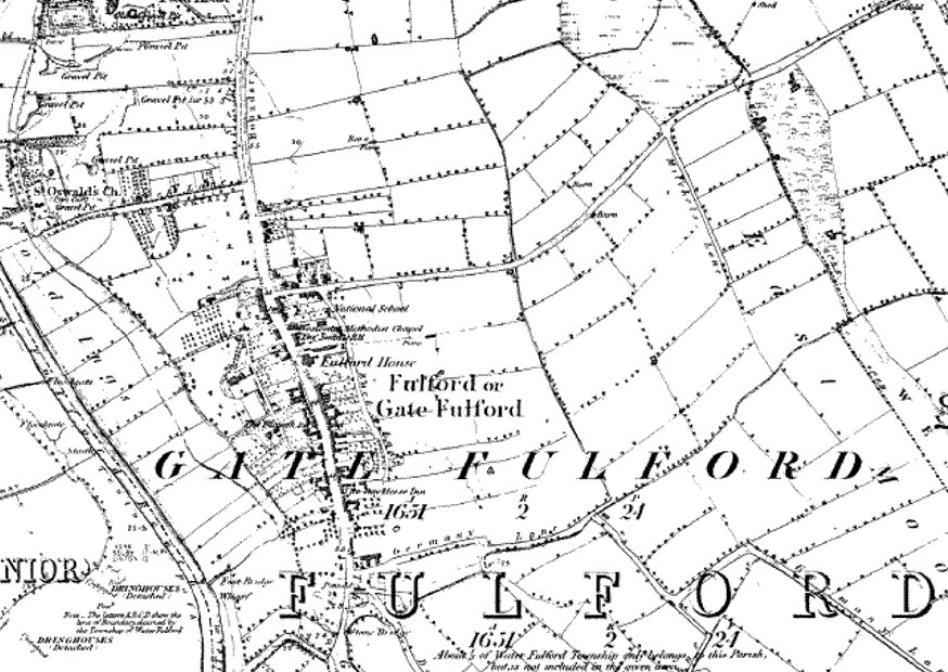
This map shows the post-conquest village called 'Gate Fulford'. The evidence suggests that the original Gate Fulford was based 700 m north and closer to the river Ouse possibly based around the old St Oswald's church. Germany Beck had already been bridged twice.

Home Search Contents Feedback Books Threat to the site

Site provided by Xhost

Keep me updated

© C Jones 2001-8
The site was updated  14 September 2008