|
Some questions
from the Battle of Fulford looking for answers |
Can you help?
|
|
|
|
|
|
The Battles of
Fulford and Stamford Bridge are related by more than their geographic and
chronological proximity. These questions relate to both battles.. |
|
|
|

The Bridges in 1066
The location of the bridges is critical to an
understanding of not only the location but also the events
themselves. |
- Was there a bridge structure at Fulford? Was it just a ford? Is
the location below the existing road?
- Where was the crossing at Stamford Bridge? Legend puts it further
north of the present structure but the ground to the south looks more
suitable. Can the location be linked to any Roman roads?
- What is the evidence for a bridge at Kexby?
- Were there any other bridges across the Derwent in 1066? Were any
other crossing points known? What about Catton?
|
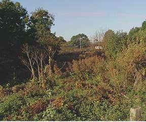
The
investigations of the geology and the
alluvial mud on top suggest that this was a good crossing point in
Roman times but by 1066, it was a wide, muddy ford.
The firm, moraine material would have provided a
firm base. |
|

The old roads
If we understood the routes that the Vikings took it might help to
understand how long reinforcements took to arrive and how fast an army
could move.
|
- What routes existed south from York to Riccall? Did the proximity of
any roads influence the choice of this mooring?
- What routes existed from Riccall to Stamford Bridge? This would
help to assess how long it would take to reinforce the Vikings on 25th
September.
- Which road would Harold have taken from London to Tadcaster? Was it
near enough that the Viking fleet moored at Riccall have been aware of
their passage?
- What roads existed from Tadcaster to York and on to Stamford Bridge?
If there were several routes the army could move faster.
- The Big One. Do the road map of 1066 help to indicate where
the Viking leaders had gone to receive their hostages? If he had been
at Stamford Bridge itself, they would have prevented Harold crossing.
Where was Harald Hardrada the night before the battle?
|
The
hunt for the road continues
but the evidence for a road at the crossing is growing. |
|

The Terrain
Ground plays a vital part in every battle. To
reconstruct an ancient battle it is vital to understand the gradients,
firmness and views as they were at the time.
|
- How much silt has been added to the Fulford
battlesite area by the regular flooding? Was flooding used to improve
the land and raise its level?
- Was the river at Riccall wide enough to turn a
longboat? Was the river further north too narrow? Did the little lakes
alongside the river at Riccall exist in 1066 as they would have
provided excellent harbours for the enormous fleet?
- Were the banks of the Ouse at Fulford just as steep
then as they are today?
- How waterlogged was the land to the west of the
Fulford battlesite? Did this provide good flank protection?
- Does anybody know of any software to convert contour
lines into a 3D projection?
- Can anybody compute the state of the tide in the Humber on 19
September 1066? (Should the date for the purpose of this calculation
be about 10 Sept allowing for the later Julian adjustment?)
|
The
alluvial buildup over the years has
been extensively studied. The details will be published during 2005. |
|
Clearing up
|
- Were the bodies collected and burnt?
- Did the Vikings conduct a ceremony for their fallen?
- Was this done immediately and who undertook the work?
|
|
|
 |
|
 |