![]()
All History Guide: Your guide to history on the Internet..
" .. this unusual, and yes, excellent history book.."
"More books like this one introducing historical study in a sympathetic was are needed.."
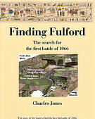
Now in paperback
... and into its 3rd reprint!
Some maps might take 10-20 seconds to download if you have a slow link, so please be patient. There are some very large images in the PR section for use in education or for the media.
Maps
Maps outlining the possible course of the battle. Map 1 outlines the terrain and shows the position of the proposed road Map 2 shows how the deployment and first phase of the battle progressed Map 3 illustrates the Viking breakthrough and destruction of the Saxons Sketch map of York's defences in 1066
|
Discussion of old maps and John Speeds mapThe Worcester MS of the Anglo-Saxon Chronicle:" gathered from their earldom as great a force as they could get, and fought with that raiding-army and made a great slaughter." But they were "killed and drowned and driven in flight; and the Norwegians had possession of the place of slaughter."Snorri's Saga says:King Harald lay in the Usa (Ouse). King Harald now went on the land, and drew up his men. The one arm of this line stood at the outer edge of the river, the other turned up towards the land along a ditch; and there was also a morass, deep, broad, and full of water.The earls let their army proceed slowly down along the ditch, with all their troops in line. The king's banner was next the river, where the line was thickest. It was thinnest at the ditch, where also the weakest of the men were. When the earls advanced downwards along the ditch, the arm of the Northmen's line which was at the ditch gave way; and the Englishmen followed, thinking the Northmen would fly. The banner of Earl Morukare advanced then bravely. When King Harald saw that the English array had come to the ditch against him, he ordered the charge to be sounded, and urged on his men. He ordered the banner which was called the Land-ravager to be carried before him, and made so severe an assault that all had to give way before it; and there was a great loss among the men of the earls, and they soon broke into flight, some running up the river, some down, and the most leaping into the ditch, which was so filled with dead that the Norsemen could go dry-foot over the fen. There Earl Morukare fell. Earl Valthiof, (Edwin) and the people who escaped, fled up to the castle of York; and there the greatest loss of men had been.
|
Graphic battle sequenceThis sequence of 6 small maps goes into more detail on the possible course of the battle. |
|
|
The local geology- The underlying geology is key to placing the battlefield. The defensive approach to York from the south was created in the last Ice Ages about 15 thousand years ago. |
|
|
Even if this was not a unique historic monument, is it wise to constrict the natural drain for the hinterland extending to the University. |
|
| Alternative
sites
Some nearby locations have been suggested as the site of the battle. |
|
| Changes
since 1066
We know of some changes to the site but there are others that might affect the interpretation of the limited evidence. |
|
| The bigger
picture
Shows the area behind the battle site including the Ings and the retreat to York. |